By car Parking: close to the Clue de Péroué Distance: 12 km from Digne-les-Bains Time: around 25 mins
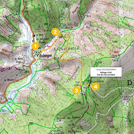
Suivre les panneaux « Musée-Promenade ». Après le pont qui traverse la rivière du Bès, prendre la D900a en direction de Barles, jusqu'au village d'Esclangon. Au pied du village, juste avant le pont vert, prendre à droite la route qui serpente entre les habitations et se garer sur le terrain plat avant le départ de la piste rocailleuse.
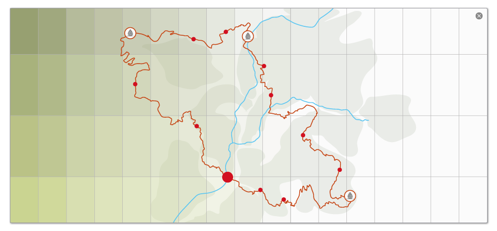
Hike Time: 2 hrs Total distance: 5.2 km Net difference in altitude: 447 m Markings: yellow
(1) Follow the main road, which leads onto a trail. At a large black gate, turn right. Follow the trail (which can be used by motor vehicles) for 400 m. There is a gate along the way, to keep cattle from straying. If you find it closed, make sure to close it again after you. (2) Go straight ahead for 300 m, then turn right along the narrow path that goes upward across the red earth. It is quite steep at the start. Continue as far as the Col de l'Escuichière, at an altitude of 1,242 m. (3) From there, go down 100 m along the path that turns off to the left. (4) The Refuge d'Art – Col de l'Escuichière is on the right.
Return by the same path.
NB : all our GPS references are given in <.gpx> format. For files in formats such as <.trk>, <.grm> and <.kml>, you can do an automatic conversion by going to tracegps.com


 Parking: close to the Clue de Péroué